The best wall maps for geography lessons turn abstract locations into something students can see, compare, and revisit every day. The right choice depends on age level, available wall space, map detail, and whether the map needs to withstand frequent handling.
We selected 10 classroom-friendly options ranging from illustrated children’s maps and compact poster sets to oversized laminated political maps. Use the guide below to match the format and features to your teaching environment.
Best 10 Wall Maps for Geography Lessons Picks for 2026
Authoritative Reference
National Geographic Executive World Wall Map

- Detailed world reference with extensive place labeling
- Winkel Tripel projection helps limit visual distortion
- Laminated 46 x 30.5-inch sheet for durable display
Best For: Detailed geography instruction and reference use
Early Learner Set
USA & World Map Posters for Kids

- Two-poster set covers the United States and world
- Bright icons and clear labels support visual learning
- Waterproof PVC supports dry-erase activities
Best For: Preschool classrooms, playrooms, and homeschool beginners
Distortion-Aware Pair
Laminated World and USA Map Set

- World map uses an Equal Earth design
- Includes matching world and USA posters
- 3 mil lamination helps resist tears
Best For: Projection discussions and paired geography displays
Illustrated Learning
Rand McNally Kids' Illustrated World Map

- Color-coded continents support easy navigation
- Features plants, animals, landmarks, and cultural icons
- Large 50 x 32-inch heavy-paper wall display
Best For: Young learners and visually engaging classroom displays
Best for True-to-Scale Learning
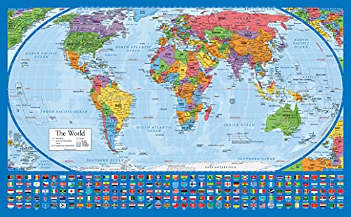
- Shows continents at true relative size
- Heavy-duty laminated and tear-resistant
- Compact 18-by-29-inch format
Best For: Teaching continental size and map projection concepts
Best Large Classroom Display
Classic Elite Laminated World Map

- Large 36-by-48-inch classroom format
- Miller projection reduces polar distortion
- UV laminate supports dry-erase use
Best For: Large classrooms and prominent geography displays
Best for Interactive Labeling

- Dry-erase surface supports reusable activities
- Labels countries, capitals, and waterways
- Color-coded details aid quick reference
Best For: Interactive classroom and homeschool geography practice
Best Value Pair

- Includes world and U.S. maps
- Durable 3 mil lamination
- Compact 18 x 29-inch posters
Best For: Classrooms and homeschool spaces needing two core geography references
Best for Young Learners
National Geographic World for Kids Map

- Covers all 195 independent countries
- Includes colorful official flags
- Child-focused 36 x 24-inch laminated design
Best For: Geography instruction for children ages 7–12
Best Large Format

- Oversized 47 x 77-inch display
- UV-coated laminated surface
- Supports dry-erase use
Best For: Large classrooms and highly visible educational displays
Authoritative Reference – National Geographic Executive World Wall Map
For detailed wall maps for geography lessons, the National Geographic Executive World Wall Map offers a research-focused reference with extensive geographic labeling. Its shaded relief, Winkel Tripel projection, and laminated finish make it well suited to classrooms, offices, and study spaces where durability and accuracy matter.
Best For: Detailed geography instruction, advanced students, and general world-reference use.
Pros:
- Includes international boundaries, cities, islands, airports, and numerous physical features.
- Shows mountain ranges and valleys with shaded relief, plus major water bodies and bathymetry.
- Uses a Winkel Tripel projection designed to reduce distortion.
- Heavy-duty 1.6 mil laminate resists humidity-related swelling and shrinking.
Cons:
- The executive antique-style palette may be less visually playful for young children.
- Its detailed labeling may be more information-dense than some introductory classroom maps.
Choose this map when authoritative detail and long-term durability are higher priorities than a child-oriented design. The corner inset maps add useful context on vegetation, land use, population density, and polar regions.
Early Learner Set – USA & World Map Posters for Kids
For early-years wall maps for geography lessons, this two-poster set pairs a colorful world map with a United States map. Artist-drawn icons, clear labeling, and a child-friendly layout support visual learning in preschools, playrooms, classrooms, and homeschool spaces.
Best For: Toddlers, preschoolers, and early learners beginning to explore countries, continents, and U.S. states.
Pros:
- Includes both USA and world maps in one educational poster set.
- Bright illustrations and artist-drawn icons encourage visual engagement.
- Waterproof, tear-resistant PVC material is designed for repeated use.
- Can be written on with dry-erase markers and wiped clean.
Cons:
- The 24 x 16-inch size provides less display area than many large wall maps.
- The child-focused presentation may not provide enough detail for advanced geography lessons.
This is a practical choice for introducing geography through repetition and visual cues. Its wipe-clean surface also allows teachers and parents to add interactive labeling activities.
Distortion-Aware Pair – Laminated World and USA Map Set
For classrooms seeking wall maps for geography lessons with a different view of global proportions, this two-map set features an Equal Earth world map design. Both posters are laminated and tear resistant, making them useful for regular classroom display and handling.
Best For: Lessons comparing world geography with U.S. geography and discussing relative continent size.
Pros:
- Includes both a world map poster and a USA map.
- Equal Earth design presents continents at true relative size.
- 3 mil lamination adds durability and tear resistance.
- 18 x 29-inch posters offer a consistent display format.
Cons:
- The supplied details do not specify additional features such as city, capital, or physical-feature labeling.
- The posters are smaller than some oversized wall maps.
This set stands out when map projection and relative continent size are part of the lesson. The matching laminated posters provide a straightforward way to display U.S. and global geography together.
Illustrated Learning – Rand McNally Kids' Illustrated World Map
For engaging wall maps for geography lessons, Rand McNally’s illustrated world map combines geographic labels with colorful visual references. Color-coded continents and drawings of plants, animals, landmarks, and cultural icons help make world geography approachable for children.
Best For: Children’s bedrooms, playrooms, and elementary classrooms that benefit from visual storytelling.
Pros:
- Color-coded continents make the map easier for children to navigate.
- Illustrations highlight native plants, animals, landmarks, and cultural icons.
- Labels capitals, major cities, and bodies of water.
- Heavy paper and a 50 x 32-inch size support prominent wall display.
Cons:
- The supplied version is paper and rolled rather than laminated.
- Illustrated details may be less suitable for highly technical or advanced reference work.
This map is a strong fit when curiosity and visual recognition are central to the lesson. Its large format gives children plenty to explore while retaining useful labels for foundational geography.
Best for True-to-Scale Learning – Equal Earth World Map Poster
For wall maps for geography lessons, this Equal Earth poster is a straightforward choice when showing continental size relationships matters. Its 18-by-29-inch format fits smaller teaching spaces, while the laminated, tear-resistant finish is designed for repeated display.
Best For: Teaching continent size and relative scale in classrooms, homeschool spaces, or study areas.
Pros:
- Equal Earth design shows continents at their true relative size.
- Heavy-duty lamination adds durability.
- Tear-resistant construction supports long-term display.
- Satin finish and blue color provide a clear, traditional map presentation.
Cons:
- The 18-by-29-inch size may offer less detail than larger wall maps.
- The notes do not indicate a write-on, wipe-off surface.
This is a useful pick for lessons focused on map projection and continental proportions. Choose a larger option if your priority is reading many labels from across a classroom.
Best Large Classroom Display – Classic Elite Laminated World Map
This 36-by-48-inch map is one of the more substantial wall maps for geography lessons, giving students a large viewing area for country and regional details. Its classic styling, Miller projection, and laminated surface make it suited to permanent classroom display and occasional annotation.
Best For: Large classrooms, geography displays, and lessons that benefit from a highly visible world map.
Pros:
- Extra-large 36-by-48-inch size is easy to view from a distance.
- Miller projection reduces land-mass distortion near the poles.
- Two-sided UV laminated coating is designed to stay flat and resist cracking or peeling.
- Gloss-coated surface supports dry-erase writing and wipe-off use.
Cons:
- The large dimensions require substantial wall space.
- Only dry-erase markers should be used on the gloss laminate.
Choose this map when visibility and durability are more important than a compact footprint. It offers a practical combination of display size, projection detail, and reusable annotation.
Best for Interactive Labeling – Political Write-On World Map
For wall maps for geography lessons that involve labeling and review, this 24-by-33-inch political map provides a reusable writing surface. It identifies countries, capitals, borders, oceans, seas, lakes, and major rivers, making it useful for guided classroom activities and independent study.
Best For: Interactive lessons, classroom quizzes, homeschool practice, and students who benefit from writing directly on a map.
Pros:
- Write-on, wipe-off coated surface works with dry-erase markers.
- Labels countries, capitals, borders, oceans, seas, lakes, and major rivers.
- Color-coded political details support quick visual reference.
- Arrives folded in a hardboard envelope for protected delivery.
Cons:
- Folded delivery may require flattening before display.
- The supplied dimensions vary between the listed paper size and item dimensions, so verify the intended display area.
- The gloss paper surface may reflect classroom lighting.
This is the strongest fit for active geography instruction because students can annotate and erase the map. It is less suited to buyers seeking a purely decorative, permanently mounted poster.
Best Value Pair – Laminated World & US Map Set
For classrooms or study spaces needing broad coverage, this two-poster set is a practical choice among wall maps for geography lessons. It includes one world map and one United States map, each measuring 18 by 29 inches, with 3 mil lamination for added durability.
Best For: Classrooms, homeschool rooms, and learners who want both world and U.S. geography references.
Pros:
- Includes both world and United States maps.
- Updated poster designs provide current reference material.
- 3 mil coated lamination adds durability and tear resistance.
- Made in the USA.
Cons:
- Each map is smaller than the oversized alternatives in this roundup.
- The supplied notes do not specify additional educational features such as flags or projection details.
This set offers strong everyday versatility when students need to compare U.S. and global geography without buying two separate products. Its manageable 18-by-29-inch format also suits walls with limited space.
Best for Young Learners – National Geographic World for Kids Map
Designed with readability and guided discovery in mind, this National Geographic map is a strong option among wall maps for geography lessons aimed at children ages 7–12. It shows all 195 independent countries with their official flags and uses a Winkel Tripel projection to reduce distortion.
Best For: Elementary classrooms, libraries, and home learning spaces for children ages 7–12.
Pros:
- Includes all 195 independent countries and their official, colorful flags.
- Flags are arranged alphabetically for easier reference.
- Winkel Tripel projection minimizes map distortion.
- Heavy-duty 1.6 mil laminate resists humidity-related swelling and shrinking.
Cons:
- At 36 by 24 inches, it requires more wall space than the smaller two-map set.
- It focuses on the world rather than including a separate U.S. map.
This is the most explicitly child-focused option in the group, combining an engaging presentation with useful reference details. The laminated finish also makes it suitable for framing without glass.
Best Large Format – 47 x 77-Inch World Map
When visibility across a large classroom or learning area matters most, this 47-by-77-inch poster stands out among wall maps for geography lessons. Its oversized format is paired with UV-coated lamination that supports durability and allows dry-erase use.
Best For: Large classrooms, offices, educational displays, and spaces where students need to view a map from a distance.
Pros:
- Extra-large 47-by-77-inch format provides high visibility.
- UV-coated lamination adds durability.
- Surface supports dry-erase use.
- Described as up-to-date and current.
Cons:
- The mural-sized dimensions require substantial wall space.
- It is a single world map, so it does not provide a separate U.S. reference.
- Ships rolled, which may require preparation before display.
This is the most impactful choice for group instruction and large-wall display. Choose it when scale and interactive dry-erase use are more important than compact storage or a two-map bundle.
How We Picked These Wall Maps for Geography Lessons
We focused on maps that support repeated classroom use and make geographic information easy to access at a glance. Selection criteria included readability, physical size, surface durability, educational usefulness, and suitability for different age groups. The roundup includes world maps, United States and world map combinations, illustrated designs, political maps, flag-focused formats, and Equal Earth projections.
Laminated products received particular attention because they are easier to clean, resist minor tears, and can often be marked with dry-erase tools when the surface allows it. Paper maps can still be a practical choice when portability, lower cost, or temporary display matters more than long-term durability.
Quick Comparison
| Best for | Look for | Most suitable options |
|---|---|---|
| Early learners | Illustrations, large labels, and simple visual organization | Kids’ illustrated and National Geographic for Kids maps |
| General classroom reference | Clear political boundaries, readable place names, and lamination | National Geographic Executive and laminated classic maps |
| Teaching map projections | A design that explains relative landmass size | Equal Earth world maps |
| Small classrooms or home study | Moderate dimensions or a two-map set | 18-by-29-inch poster sets |
| Interactive lessons | Write-on, wipe-off surface and generous scale | Political write-on map |
| High-visibility display | Oversized dimensions and bold labeling | 36-by-48-inch or 47-by-77-inch maps |
Key Buying Factors for Wall Maps for Geography Lessons
Size and Viewing Distance
Measure the wall before buying. A compact map may be easier to place above a desk or bulletin board, while a 36-by-48-inch or larger map is better for whole-class viewing. Check whether students seated at the back can read the labels without moving closer.
Map Projection and Purpose
Political maps are useful for countries, borders, capitals, and regional comparisons. Equal Earth designs help students discuss relative continent and country sizes more accurately than some familiar projections. Choose the projection that supports the lesson rather than treating one design as universally best.
Durability and Surface
Lamination is valuable in busy classrooms, especially where maps may be touched, moved, or exposed to spills. If students will label locations directly, confirm that the product is explicitly described as write-on and wipe-off; ordinary lamination does not guarantee marker compatibility.
Label Density and Age Level
Younger students generally benefit from uncluttered layouts, illustrations, and prominent labels. Older students may need more countries, physical features, flags, borders, and smaller place names. A highly detailed map is not automatically better if students cannot read it from normal viewing distance.
Who Should Buy Which Wall Maps for Geography Lessons?
For elementary classrooms: Choose an illustrated children’s map or National Geographic for Kids design with clear, engaging visual cues.
For teachers covering world geography broadly: A laminated executive or classic political map offers dependable everyday reference value.
For lessons about scale and representation: Select an Equal Earth map to prompt discussion about continent size and map projection choices.
For flexible, space-conscious setups: A combined United States and world map set provides two references without requiring one oversized display.
For interactive instruction: A write-on, wipe-off map is the most practical option for labeling exercises, review games, and temporary route marking.
For auditoriums, large classrooms, or permanent displays: Choose an oversized laminated map, but verify wall strength, mounting hardware, and viewing distance first.